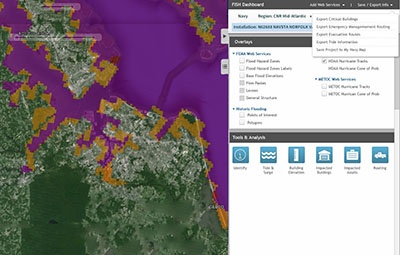
The Naval Facilities Engineering Command (NAVFAC) receives requests throughout the year concerning the impacts of flooding to Navy installations and assets. These questions typically revolve around the Federal Emergency Management Agency (FEMA) Flood Insurance Rate Maps (FIRMs), tidal surge due to hurricanes and storms, sea level rise impact, and flooding from large rainstorms. The inquiries come from various stakeholders and range from Naval facilities planning to recovery phases of flood impacts. In keeping with the GeoReadiness Program’s guiding principles of accelerating data sharing and innovation, the Navy team called upon Axim Geospatial to develop a solution called the Flood Inundation and Surge Hazard (FISH) tool. The primary goal of FISH was to empower Navy users to perform analysis of flood impacts on Navy assets in order to understand, mitigate, and respond to those challenges. Ultimately, NAVFAC wanted to save time and money by giving Navy users the ability themselves to perform analysis, assess impacts, and independently generate map products.


