This article was written regarding work conducted under legacy company names: Continental Mapping, GISinc, or TSG Solutions. These three companies merged in January 2021 to form a new geospatial leader Axim Geospatial.
The Philadelphia District, U.S. Army Corps of Engineers (USACE) needed to communicate complex, mission-critical information quickly and effectively across the organization while leveraging the out-of-the-box configuration of their current Esri portal application framework.
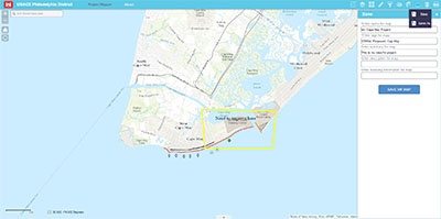
By overhauling the existing Flex API application, Project Mapper, the Philadelphia Corps of Engineers envisioned a simplified user experience with predictable behavior, high availability, standardized project map templates and layouts, portable widgets, user workflows, and GIS content generator access for all users.
Axim Geospatial's Project Mapper solution is a simple, one-stop portal that makes project data integration, visualization, discoverability, and management possible leveraging the Esri Portal extension, ArcGIS for Server 10.3, Web AppBuilder for ArcGIS, and the JavaScript API – resulting in a scalable framework for additional capabilities, applications, or tools.
The Philadelphia Corps of Engineers is now able to view, customize and share standardized project maps using simple and user-friendly map-based project information. Data dashboards also provide project stakeholders with seamless, unified front-end access to integrated enterprise ERP, project management data, and related maps that can be customized per user permissions that leverage an active directory for single sign-on.
Workflows enable cross-pollination between federated map services and the Portal App while QA/QC controls are applied to ensure that content is reviewed and validated prior to publication. Users can also add ArcGIS map services into a given project map to define how project data is rendered; they can even use tools to markup the project map as desired.
With the success of the Project Mapper solution, the Philadelphia Corps of Engineers is demonstrating how the United States Department of Defense can leverage Esri ArcGIS for Server 10.3 and the Portal for ArcGIS extension to support a portfolio of business applications efficiently and effectively while minimizing costs.


