This article may reference legacy company names: Continental Mapping, GISinc, or TSG Solutions. These three companies merged in January 2021 to form a new geospatial leader [Axim Geospatial].
“Improvise, Adapt and Overcome”
Marines are taught from day-one to overcome any obstacle, which serves us well in the chaos of combat. This concept is encapsulated in the Marine slogan “Improvise, Adapt, and Overcome,” which is a mindset that allows Marines to deal with any physical, mental, or spiritual hardship. As an old Devil Dog my self I thought about this as I watched a live stream of this year’s Esri’s Developer Summit out of my home and office in Boise, ID.
You see, for the past 10 years I’ve been attending Esri’s Developer Summit in-person in sunny Palm Springs, CA. This year, due to circumstances surrounding the coronavirus, the Developer’s Summit was held virtually. I have to admit, at first, I was disappointed. I looked forward to meeting up with friends, colleagues and the 100s of Esri’s professionals that work extremely hard to deliver a top-notch conference showcasing the evolution of ArcGIS.
As I would suspect, Esri put on an excellent virtual plenary opening up DevSummit, which this year will span several weeks as they make available all technical sessions and pre-conference workshops as either recorded sessions, live webinars or MOOCs (Massive Open Online Classes).
- Access the recorded plenary sessions here.
- And look for information on the developer technical sessions and workshops here.
What did I take away from this year’s DevSummit plenary?
Well for starters, Esri truly has that “Improvise, Adapt and Overcome” mentality. So, from one Marine to another “Oorah!” Thanks for finding a way to keep the knowledge, ideas and innovation flowing.
Here’s a quick rundown of some of the innovations that excited me at this year’s DevSummit Plenary:
1. Arcade Expanding Into the Platform
Arcade is a simple, portable scripting language for creating custom visualization and labeling expressions accessible through the ArcGIS API for JavaScript, ArcGIS Online, ArcGIS Pro and ArcGIS Runtime. Arcade has now found its way into Operations Dashboard for ArcGIS. Look for a beta release in the next few weeks.
Learn more about Arcade here.
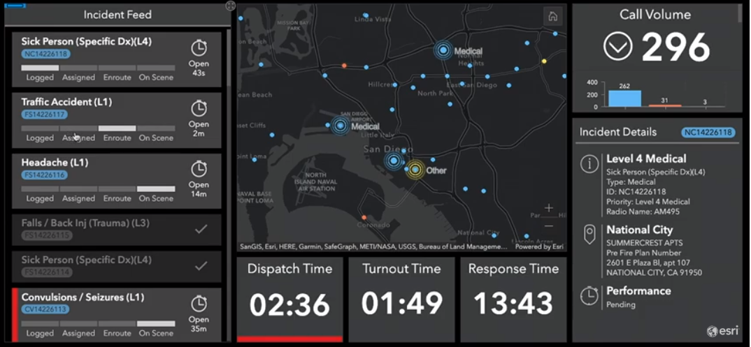
Screen shot shown at the plenary of Arcade expressions in the Operations Dashboard
2. ArcGIS App Builders
Web AppBuilder and AppStudio have been around for a few years now and provide developers a jumpstart into building Web and Native applications with little or no code. Now introducing ArcGIS Experience Builder, built on top of the ArcGIS API for JavaScript 4.x, React and Redux providing a mapcentric or non-mapcentric approach to building complete web solutions not just web maps.
Learn more about ArcGIS Experience Builder here.
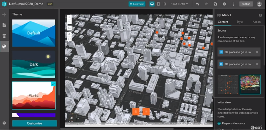 Screen shot shown at the plenary of ArcGIS Experience Builder
3. Spatial Analysis and Data Science
This year’s DevSummit showed a wide range of enhancements to the ArcGIS Platform throughout the APIs, SDKs and Solutions such as: distributed geoanalytics, multidimensional analysis, deep learning and full motion video analysis, natural language processing, artificial intelligence, and machine learning. A key component to making this happen throughout the APIs and SDKs in the new ArcGIS API for Python modules called arcgis.learn.
Learn more about ArcGIS API for Python here.
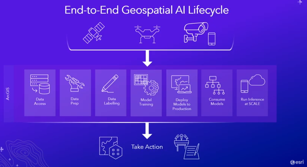 Screen shot shown at the plenary of the Geospatial AI Lifecycle
4. ArcGIS in Gaming Engines
Yes, new to the ArcGIS Platform are two integration plugins for Unity and UNREAL gaming engines. Esri understands that these gaming engines provide another level of rendering experience, a easily integrated and cross hardware development environment, a huge existing developer community and access to things like physics, animations, particle systems and other effects. ArcGIS for Game Engines is currently in Beta and set to be released later this year.
Sign up for the beta here. Watch the plenary recording here.
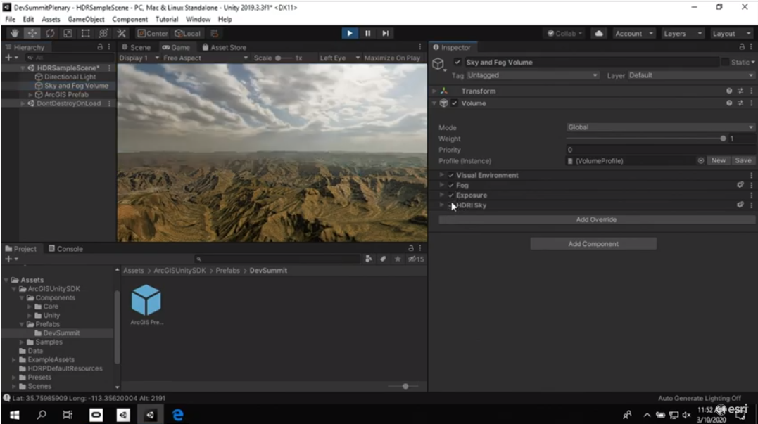 Screen shot shown at the plenary of Unity and ArcGIS for Gaming Engines
5. ArcGIS Enterprise on Kubernetes
For years cloud computing has been evolving to provide developers a platform for extending Web and Mobile solutions beyond the traditional development and deployment strategies through what the industry is now calling Cloud Native Computing. We’ve seen developers write code and deploy to the cloud; this is often known as Cloud Ready. The next evolution in cloud computing would be to develop code that takes specific advantage of cloud services which is known as Cloud Optimized. ArcGIS Online, ArcGIS Enterprise fall into this category. Esri has been working hard to take that next step with ArcGIS and move into the Cloud Native Computing world by reengineering ArcGIS to fully utilize cloud computing open source software stacks to deploy ArcGIS as microservices. What does this mean? ArcGIS will be built as a set of microservices that run in Docker containers, orchestrated in Kubernetes and managed and deployed using DevOps and potential GitOps workflows.
Esri has taken the first steps with the release of ArcGIS Analytics for IoT
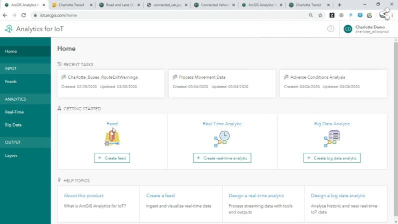 Screen shot shown at the plenary of ArcGIS Analytics for IoT
Things you should start to be aware of:
Additional Guidance
We hope this article has provided some value to you! If you ever need additional help, don't hesitate to reach out to the Axim team.


